
Australia's rivers run through some of the driest landscapes on Earth. Despite being known for arid plains and deserts, Australia is home to thousands of waterways that support cities, farms, and ecosystems. Australia's river systems are fascinating, and here are just some of the key ones.
| River | Length (km) | States/Territories | Basin | Key Features |
|---|---|---|---|---|
| Murray River | 2508 | NSW, VIC, SA | Murray–Darling Basin | Australia’s longest river; vital for irrigation, wetlands, and regional agriculture |
| Darling River | 1472 | QLD, NSW | Murray–Darling Basin | Historic inland river; intermittent flow; joins the Murray at Wentworth |
| Murrumbidgee River | 1485 | NSW, ACT | Murray–Darling Basin | Passes through Canberra; key tributary of the Murray; used for irrigation and hydro power |
| Lachlan River | 1440 | NSW | Murray–Darling Basin | Ends in the Great Cumbung Swamp; variable flow; supports agriculture and groundwater |
| Cooper Creek | 1300 | QLD, SA | Lake Eyre Basin | Ephemeral desert river; floods reach Lake Eyre; site of Burke and Wills expedition |
| Fitzroy River | 733 | WA | Fitzroy Basin | Northern Australia’s largest unregulated river; home to barramundi and sawfish |
| Flinders River | 1004 | QLD | Gulf of Carpentaria Division | Queensland’s longest river; seasonal flow from Great Dividing Range to the Gulf |
| Mitchell River | 750 | QLD | Gulf of Carpentaria Division | Flows through tropical rainforest and savanna; supports major wetland systems |
| Gordon River | 172 | TAS | Gordon–Franklin–Huon System | Protected wilderness river; site of historic Franklin Dam campaign |
| Diamantina River | 900 | QLD, SA | Lake Eyre Basin | Episodic desert river; flows after monsoon rains; merges with Warburton River |


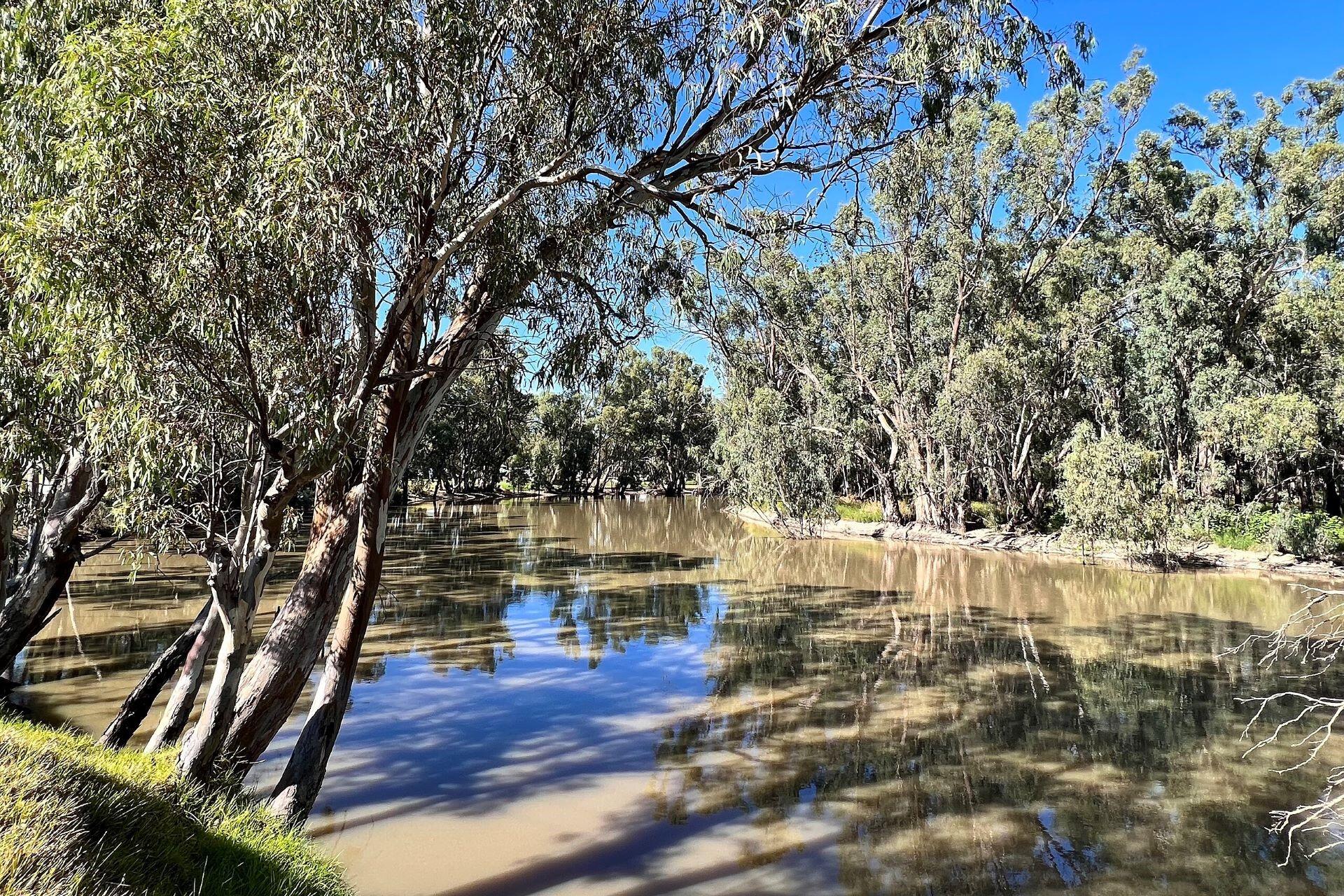
Murray River
The Murray River is Australia's longest. It stretches nearly 2,508 kilometres from the Snowy Mountains, some of Australia's biggest mountains, in New South Wales, through Victoria and South Australia, before it gets to the Southern Ocean at the Murray Mouth near Goolwa.
This river is the lifeline of the Murray-Darling Basin, supporting irrigation, drinking water, and wetland ecosystems in the southeast. The Murray also flows past key regional centres like Albury, Echuca, and Mildura, making it a vital part of Australia's Agricultural economy.
It also plays a key role in biodiversity, with wetlands like the Barmah-Millewa Forest and the Coorong. There have been periods of drought and salinity. Restoration projects are looking to protect the flow and health of the river¹.
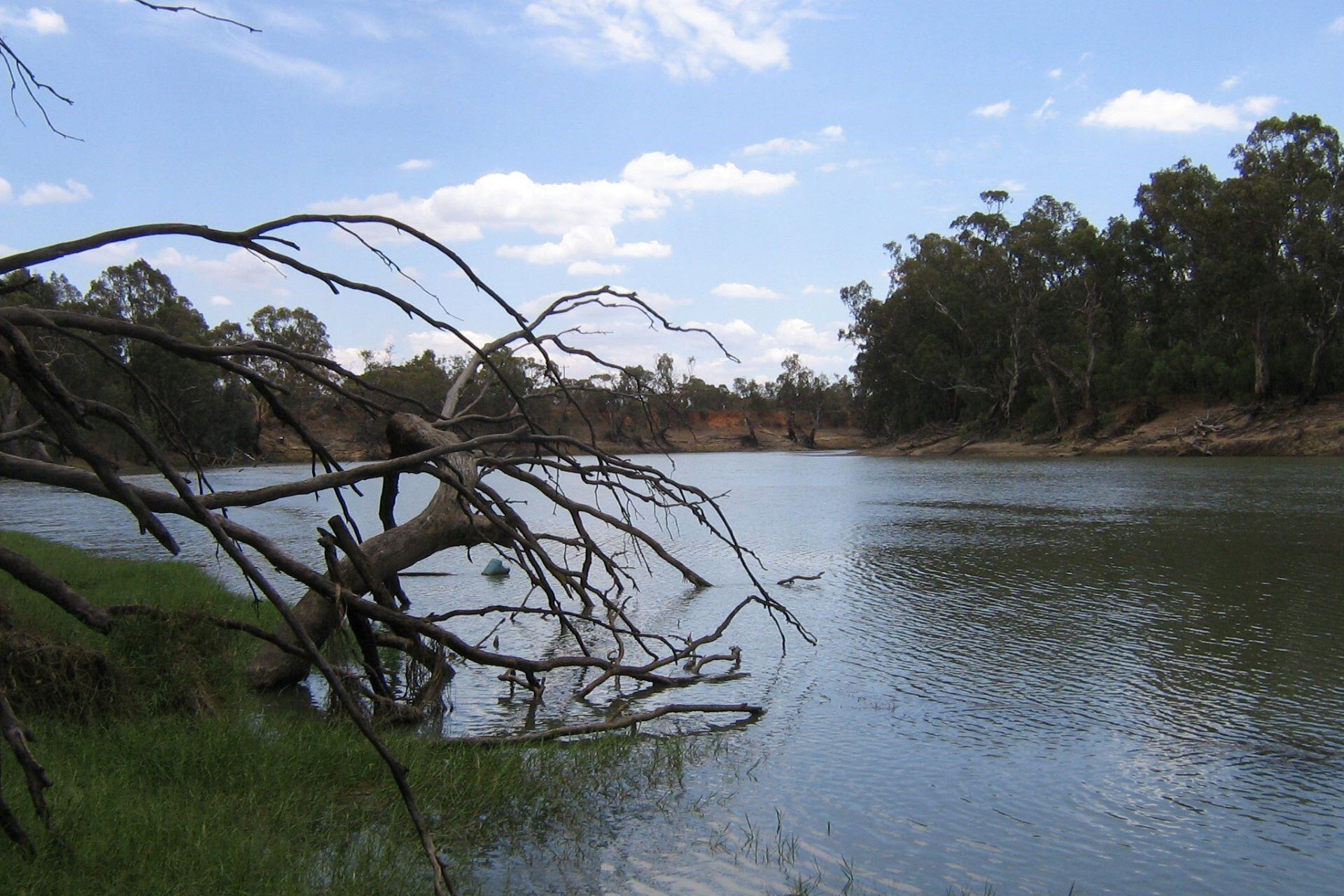
Darling River
The Darling River flows for around 1,472 kilometres. This is one of the country's longest and most historically significant inland rivers. It originates from the Condamine and Balonne headwaters in Queensland, meandering southwest through New South Wales before joining the Murray River at Wentworth.
It's part of the vast Murray-Darling Basin. It plays a critical role in supporting agriculture and rural communities in inland Australia. However, the river is known for irregular flows and depends heavily on seasonal rainfall and upstream water management, typical of Australia's climate. During droughts, it can become a series of disconnected pools, while at other times, it's a wide, dynamic watercourse. For Aboriginal peoples, particularly the Barkdanji (meaning "people of the river"), the Darling holds deep cultural and spiritual value. Ongoing conservation efforts are aiming to preserve this river².
Murrumbidgee River
The Murrumbidgee River is a 1,485-kilometre river. It's one of the key tributaries of the Murray and an essential artery within the Murray-Darling Basin. It rises in the Snowy Mountains, near Cooma before flowing through the Australian Capital Territory, winding past Canberra, and joining the Murray River near Balnranald in New South Wales.
It gets its name from the Wiradjuri language, and it means "big water". Its floodplains have supported agriculture for generations and provide irrigation for crops and livestock in southern New South Wales. The river is also famous for the Snowy Mountains Hydroelectric Scheme, where water is used to generate power and supply inland regions.
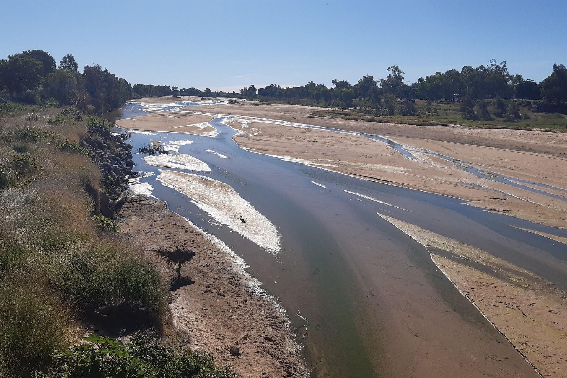
Lachlan River
The Lachlan River runs through central New South Wales. It's another key tributary within the Murray-Darling Basin. It starts at the Great Dividing Range near Goldburn and flows westward through towns like Cowra and Forbes. Eventually, it reaches the Great Cumbungi Swamp, where the water dissipates into a vast wetland. This river's flow is highly variable, alternating between long dry spells and heavy floods. This has shaped the agricultural landscapes, which rely on it for irrigation and stock water.
The Lachlan River's catchment supports a variety of diverse ecosystems, including river red gum forests and native fish species like the Murray Cod. Due to its unpredictable nature and its central role in local water management strategies, the needs of farming, ecology, and regional communities must be balanced.
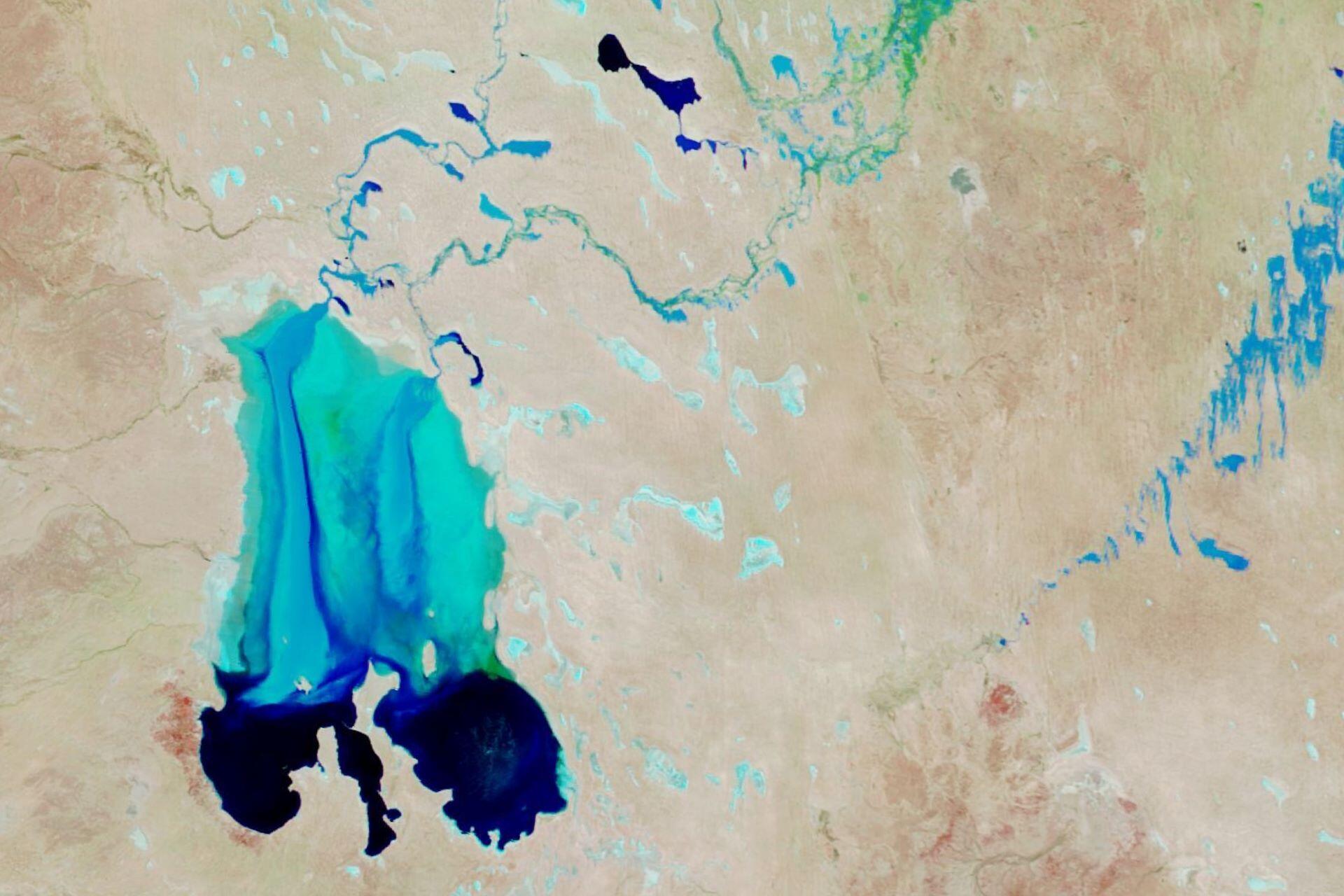
Cooper Creek
Cooper Creek is an iconic inland waterway. It flows across Queensland and South Australia. It's formed by the confluence of the Barcoo and Thomson rivers and winds through the arid Channel Country before emptying into some of Australia's biggest lakes during flood years. Generally, its channels are isolated waterholes that sustain wildlife and cattle grazing in the driest regions.
It was on the banks of Cooper Creek that explorers Burke and Wills met their fate in 1861 during their expedition to cross the continent. However, despite its harsh conditions for 19th-century explorers, the creek supports ecosystems of fish, waterbirds, and vegetation that thrive when the floodwaters arrive. It's one of Australia's most extraordinary desert river systems.
Fitzroy River
The Fitzroy River flows through the rugged Kimberley region of Western Australia. From the King Leopold Ranges, it travels westward across remote cattle country before reaching King Sound near Derby. This is one of northern Australia's largest unregulated river systems. This means that the Fitzroy is largely free-flowing and ecologically pristine.
Seasonal monsoon rain turns it into a wide river that floods floodplains, replenishes aquifers, and sustains wildlife. The waters of the Fitzroy River are home to rare species like freshwater sawfish and the northern river shark. The river is also culturally crucial for Indigenous groups like the Banuba and Gooniyandi peoples.
Flinders River
The Flinders River is the longest in Queensland. It stretches for over 1,000 kilometres from the Gregory Range to the Gulf of Carpentaria. It provides a vital water source for both communities and ecosystems in northwestern Queensland. During the wet season, the river swells into a vast floodplain network. However, during the dry months, it becomes an isolated pool.
The Flinders River is part of the Gulf of Carpentaria Drainage Division, which is one of the most intact river systems on the continent. There are agricultural development projects aimed at balancing environmental health with regional growth, and the seasonal rhythms make it an essential feature of Queensland's tropical landscapes.
Mitchell River
The Mitchell River flows across Far North Queensland from the Atherton Tablelands through the tropical savanna and rainforest to the Gulf of Carpentaria. An ecologically rich, unregulated river, it supports extensive wetlands, mangroves, and floodplains.
The river's basin is home to native fish species and migratory birds, which makes it an important site for biodiversity conservation. It's also an important site for the Kuku Yalanji and Kowanyama peoples, whose livelihoods and traditions are tied to the river's seasonal cycles.
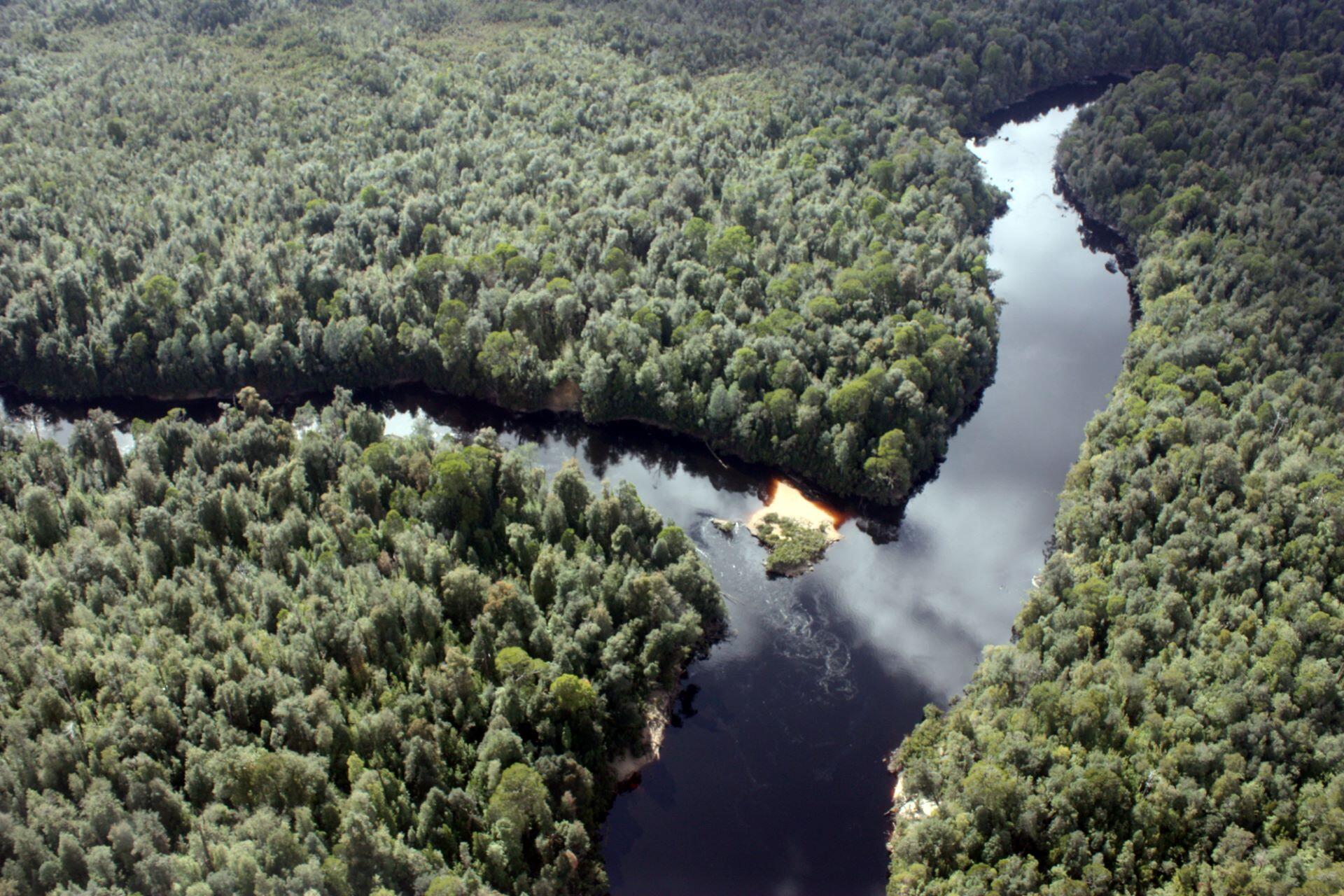
Gordon River
The Gordon River flows through western Tasmania's rugged wilderness. It starts in the King William Range before flowing southwest through ancient temperate rainforest and entering the Macquarie Harbour near Strahan. It's a key part of the Tasmanian Wilderness World Heritage Area and famous for its pristine air and the lush forests of Huon pine, home to some of the oldest living trees on Earth. The Gordon was at the heart of Australia's environmental movement during the 1980s campaign to stop the Franklin Dam. Today, you can visit its water through eco-cruises.
Diamantina River
The Diamantina River flows through central and southwestern Queensland and joins the Warburton River. It begins in the Swords Range, west of Longreach, before winding through Chaneel Country. In the wet years, the Diamantina floods create a network of channels and lagoons supporting fish, waterbirds, and desert wildflowers. In dry periods, it becomes a series of billabongs and waterholes, which wildlife and livestock use as refuges¹.
References
- Murray–Darling Basin: River Systems and Management. (n.d.). Murray–Darling Basin Authority. Retrieved October 9, 2025, from https://www.mdba.gov.au/discover-basin/river-system
- Darling River and the Baaka. (n.d.). NSW Department of Planning and Environment. Retrieved October 9, 2025, from https://www.dpie.nsw.gov.au/water/water-for-environment/basin-catchments/darling-baaka
- Murrumbidgee Catchment. (n.d.). NSW Government – Environment, Energy and Science. Retrieved October 9, 2025, from https://www.environment.nsw.gov.au/topics/water/water-for-the-environment/murrumbidgee
- Lachlan Catchment and Great Cumbung Swamp. (n.d.). NSW Department of Planning and Environment – Water. Retrieved October 9, 2025, from https://www.dpie.nsw.gov.au/water/water-for-environment/basin-catchments/lachlan
- Cooper Creek and Lake Eyre Basin. (n.d.). Queensland Department of Environment, Science and Innovation. Retrieved October 9, 2025, from https://www.qld.gov.au/environment/water/catchments/lake-eyre
- Fitzroy River. (n.d.). Government of Western Australia – Department of Water and Environmental Regulation. Retrieved October 9, 2025, from https://www.wa.gov.au/organisation/department-of-water-and-environmental-regulation/fitzroy-river
- Flinders River Catchment. (n.d.). Queensland Department of Environment, Science and Innovation. Retrieved October 9, 2025, from https://www.qld.gov.au/environment/water/catchments/flinders
- Mitchell River Basin. (n.d.). Queensland Department of Environment, Science and Innovation. Retrieved October 9, 2025, from https://www.qld.gov.au/environment/water/catchments/mitchell
- Gordon River. (n.d.). Tasmania Parks and Wildlife Service. Retrieved October 9, 2025, from https://parks.tas.gov.au/explore-our-parks/gordon-river
- Diamantina River and Channel Country. (n.d.). Queensland Department of Environment, Science and Innovation. Retrieved October 9, 2025, from https://www.qld.gov.au/environment/water/catchments/diamantina
Summarise with AI:
Did you like this article? Leave a rating!


