

"I began studying geography because I wanted to learn more about the world I live in." - Alice Hyde
Simply put, the world is an awe-inspiring place. The diversity of cultures and geography experienced in each country makes travelling the world a moveable feast.
Therefore, without further ado, in today's article, we will consider some of the most mind-blowing geography facts from each of the world's continents.
To attain a thorough understanding of the entire geography subject visit this link.


Africa
"I never knew of a morning in Africa when I woke up and was not happy." -Ernest Hemingway
Comprised of 54 countries, Africa is the world's second continent in terms of area and population. Known for its breathtaking scenery and a wide variety of animal species, Africa is a continent worthy of discovery.
What are some interesting geography facts about Africa?
The following are some of the most captivating geography facts about Africa that make it a unique place:
- Africa is the only continent that resides in all four hemispheres- the western, the eastern, the northern, and the southern; indeed a unique feat!
- Home to the second largest river the Nile that rises south of the Equator and flows northward into the Mediterranean Sea; its drainage basin covers 11 countries.
- The Sahara desert is the world's largest hot desert and the third largest desert after Antartica and the Arctic covering a total area of 9,200,000 square kilometres.
- Mount Kilimanjaro is the African continent's highest peak at 5,895 metres (19,341 feet). Since Kilimanjaro is one of the seven summits, it is a major international climbing destination.
- The largest religion in Africa is Islam, closely followed by Christianity.
The facts mentioned above provide readers and curious geography enthusiasts with interesting geographic information that makes Africa different from the other continents.
Antartica
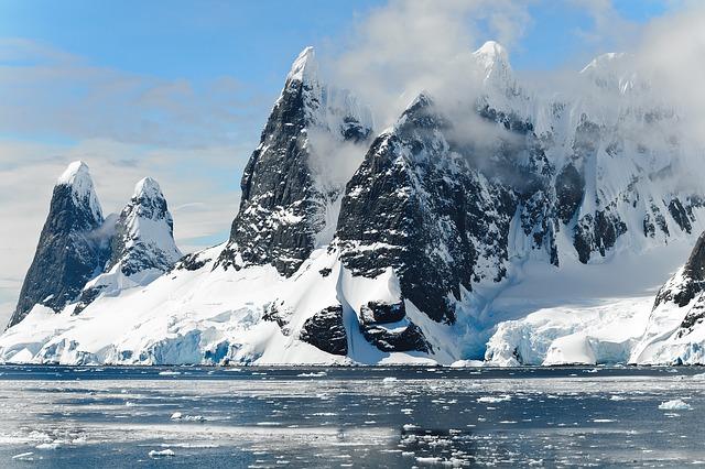
"If Antartica were music it would be Mozart. Art, and it would be Michelangelo. Literature, and it would be Shakespeare. And yet, it is something even greater; the only place on earth that is still as it should be. May we never tame it." -Andrew Denton
Antartica is the last region in recorded history to be discovered. It is the world's fifth largest continent in terms of area, and the seventh most populous continent with an approximate population of only 1,106 people, all being scientific explorers.
The following are the best geography facts about Antartica that make it stand out among the rest of the world's continents:
- Antartica is the coldest, driest, and windiest continent; also, has the highest average elevation of all the world's continents. It's no surprise that Antartica is the coldest since temperatures have reached -89.2 celsius. That's damn cold!
- 90% of the world's ice is found on Antartica and 70% of all fresh water.
- During the winter time, Antartica almost doubles in size as sea ice begins to form and accumulate around the shorelines.
- The Antartic continent is the most extensive single ice sheet in the world covering an area of almost 14 million square kilometres. Scientists have discovered that if global warming continues and the ice sheets melt, the level of oceans would rise by nearly 200 feet (60m); we seriously need to make a change and think of our future.
While Antartica is the most deserted and desolate climate, it is a source of intrigue to adventurers from all over the globe.
Asia
"Asia is rich in people, rich in culture and rich in resources. It is also rich in trouble." -Hubert H. Humphrey
Asia is the world's largest and most populous continent with a total area of 44,579,000 square kilometres and over 4.462 million inhabitants. Known for its distinct cultures, booming economies, stunning scenery, and overpopulated cities, Asia is a feast for the senses.
Superprof has found the following geographic facts that make Asia super special:
- Asia is home to the world's highest point on land and lowest. For example, Mount Everest, located on the border between Nepal and China is the tallest mountain and highest point on earth at 29,029 feet above sea level (8,848 metres), and the Dead Sea, located between Isreal, Jordan, and Palestine is at 1,412 feet (430 metres) below sea level making it the lowest point on planet earth.
- With a population of over 4.4 million, Asia has more inhabitants than all other continents combined. India and China are the only countries in the world that boast more than 1 billion inhabitants each, and out of the top ten most populous cities in the world, seven are in Asia.
- China, one of the largest countries in the world in terms of area, borders 14 countries and only has one national time zone.
- Indonesia, located in Southeast Asia, is the world's largest archipelagic country with over 17,000 islands.
- Mongolia has the lowest population density in the world with only about 3 million inhabitants occupying a total area of 1,564,116 square kilometres.
Since it is so extensive, many geographic facts are worthy of admiration and examination in the continent of Asia.
Europe

"Oh, lovely Europe, your flowers and your wine, your bread, your music." -Belva Plain
Europe covers about 10,180,000 square kilometres of area and is the third-most-populous continent in the world with over 741 million inhabitants. Europe captures the heart of travellers who fall in love with the art, history, food, and people of the 50 sovereign states; there is no denying the fact that Europe is one of the world's most beautiful continents.
The following are some compelling facts about geography that make Europe unique:
- Europe is home to two countries that are landlocked by Italy. San Marino and Vatican City are sovereign states that are surrounded by the country of Italy. It is also essential to state that Vatican City, the Pope's hood, is the smallest country in the world.
- Rome was the first city to reach a population of a million people. Also, Rome had a profound impact on other continents since there is a city called Roma in every continent except Antartica.
- Istanbul is the largest city in the world that is on two continents: Europe and Asia. The Bosphorus River separates the European and Asian sides of Istanbul.
- The Greek national anthem consists of 158 verses, and it is not known if there is a Greek person that has memorised the entire song.
- Monaco, one of the world's smallest countries, is also one of the world's most densely populated nations with a total number of 38,400 citizens living in an area of 2.02 kilometres squared.
All of the previously mentioned geography facts make eccentric Europe even more lovable.
North America
"The biggest disease in North America is busyness." -Thomas Merton
North America is the third-largest continent in the world with a total land mass of 24,709,000 square kilometres. The North American continent features over 579 million inhabitants from various backgrounds and cultures. Known for its busy lifestyle, breathtaking nature, and rich history, North America is a continent worthy of visiting.
The following are a few interesting facts about North America:
- The Arctic Ocean surrounds North America in the north, the Pacific Ocean in the west, and the Atlantic Ocean in the east.
- Canada is home to more than half of all the natural lakes in the world, and 9% of the country is covered in water.
- No spot in Central America is more than 201 kilometres (125 miles) from the ocean; Atlantic or Pacific.
- Since New York City is one of the top ten most populated cities in the world, there is bound to be intriguing geographic facts about its boroughs. For example, Manhattan, the most densely populated district, features 43 buildings that have their zip code.
North America is a relatively new continent in comparison to others, but friendly people and distinct cultures make it a place worthy of visiting.
Oceania
"Oceania is vast, Oceania is expanding, Oceania is hospitable and generous, Oceania is humanity rising from the depths of brine and regions of fire deeper still, Oceania is us. We are the sea, we are the ocean." -Epeli Hau'ofa
Oceania is the 6th continent in terms of total area and population; with an area of over 8.5 million square kilometres and over 40 million inhabitants. Oceania comprises of Australasia, Melanesia, Micronesia, and Polynesia. Known for its laidback lifestyle and gorgeous beaches, Oceania is a dream come true.
Superprof has found the following facts about Oceania:
- Fewer people live in Australia than in the state of Texas. Also, it has been discovered that there are more sheep in Oceania than there are people.
- It is has been estimated that there are over 25,000 volcanic or tropical islands scattered over a vast area of the Pacific Ocean.
- Australia is the only home of unique animals such as the koala, the kangaroo, and the emu.
A visit down under to the continent of Oceania is a trip worth taking!
Find more geography lessons here on Superprof.
South America

"There's nowhere like home for me, but there has been something so interesting about most of the places I've visited. One that sticks out in my mind is traveling around South America. It's a huge continent, and I only got to see a small portion of it, but I've always liked going there." -Brittany Bowe
A continent of stark contrasts, South America, is an addiction among travellers from countries all over the world. South America is the fourth largest continent in terms of area (over 17,840,000 square kilometres) and the fifth most populous with over 420 million people. Known for Machu Picchu, the Iguazu falls, and the Salar de Uyuni, South America is a breathtaking cultural experience that needs to be had.
The following are some geographic facts about South America:
- South America is home to two of the world's largest countries: Brazil and Argentina. Brazil covers more than half of South America's landmass, and Argentina is the largest Spanish speaking country in the world.
- The Amazon river has the most significant rate of volume flow in the entire world.
- San Atacama Desert in Chile is the driest place in the world; some weather stations in San Atacama have never received any rain!
- Mount Chimborazo in Ecuador is the closest mountain to the moon.
- The Andes Mountains are the most extended continental range of mountains in the world.
There you have it geography geeks, some of the most intriguing facts of geography from the world's seven continents; are you inspired to take a gap year and travel the beautiful world we reside on? We sure hope so!
Take a peek at the following geography-based blogs:
Summarise with AI:
Enjoyed this article? Leave a rating!


